Field Study will Reveal More about Wellington's Earthquake Risk

Portable seismographs will be installed at 900 locations in the lower North Island as part of a field study that will help scientists better understand earthquake hazards in the region.
The mini earthquake recorders will be buried at regular intervals, sometimes just 100 metres apart, in a 100 kilometre line between the Wairarapa and Kapiti coasts. Scientists will then detonate explosive charges in deep bore holes and use the seismographs to record the sound waves being reflected back from rock interfaces deep in the earth.
The 21-day project, which began last week, involves scientists from Victoria University, GNS Science, Tokyo University and the University of Southern California.
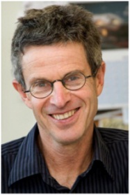
Professor Tim Stern (pictured), from Victoria‘s Institute of Geophysics, says the project is one of the largest of its kind to be carried out in New Zealand and will deliver valuable information about the rocks deep under the North Island.
"The seismographs will tell us about the thickness and mechanical state of rock units beneath the seismic line down to depths of 50 kilometres or more."
He says that data will contribute to building a high resolution 3D image, similar to that produced by a CAT scan, of the rock structures and the tectonic plate boundary beneath the lower North Island.
He says ultimately the goal is to learn more about the risks from earthquake through improved knowledge of the structure of the earth‘s crust in the Wellington area.
A particular focus will be the boundary between the Pacific and Australian tectonic plates that lies at a depth of only 20 to 30 kilometres beneath the southern North Island.
The field trials are phase two of a project called SAHKE (Seismic Array – Hikurangi Experiment) which began in 2009. During the first phase, scientists recorded local, regional and teleseismic earthquakes and offshore seismic airgun blasts over a five month period to image deeper structures associated with the subduction zone under the lower North Island.
The 'walkman seismographs' being used in phase two are small and light and have a maximum battery life of seven days, making timing a crucial issue. Teams made up of scientists and students from Victoria‘s Institute of Geophysics, GNS Science and the universities of Tokyo and Southern California will spend two days deploying the recorders which will then be left to record the blasts over three to four days.
Professor Stern says scientists will spend some months combining and analysing the data from both phases of SAHKE with first results expected by the end of this year.
The researcher is using data gathered in phase one of SAHKE to look at the structure of the Wanganui Basin, a young and rapidly descending area which is underlain by some of the thickest crust in New Zealand.
"As subducted plates go down they can distort the earth‘s surface but it is usually very difficult to measure that distortion. The Wanganui Basin is one of the few places where we can relatively easily access a record of plate tectonics in New Zealand."
