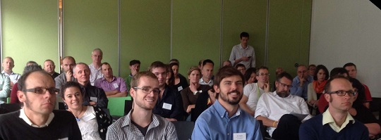
The Wellington ESRI GIS Regional Meeting April 11th 2014
On the 11th of April this year, the School of Geography, Environment and Earth Sciences (SGEES) sponsored the ESRI GIS User Group meeting in Wellington. This meeting attracts participants from industry, government and the tertiary sector to dissemination information on GIS projects in the region.

On the 11th of April this year, the School of Geography, Environment and Earth Sciences (SGEES) sponsored the ESRI GIS User Group meeting in Wellington. This meeting attracts participants from industry, government and the tertiary sector to dissemination information on GIS projects in the region. This was the 5th meeting of a series of regional meetings throughout New Zealand. The meeting attracted just under 80 people. The School was well represented with seven attendees and a number of recent alumni.
Andrew Rae, the SGEES GIS Technician, is a member of the national ESRI GIS User Group committee and he organised the day’s events as well as brought his unique charm and wit to the event by acting as MC.
These meetings inform GIS professionals on updates to the tools and software. The meeting hosted two workshops by Eagle technology on updates and developments in ArcGIS. Many of these developments are focused around mobile services and cloud computing. Of particular interest to spatially aware researchers is the provision of a soon-to-be-released free web service of LINZ aerial photography that will work both with ArcGIS and other GIS software, such as MapInfo.
Talks during the day covered nutrient farm management systems (of particular interest to SGEES researchers working in hydrological modelling), addressing and geocoding, automation of mapping services using Python, fence maintenance and the greater availability through web services of Statistics New Zealand data. Mairead de Roiste, SGEES Senior Lecturer in GIS, presented on her work with the Institute for the Study of Competition and Regulation (ISCR) on their SET (Spatial Econometric Transport) model.
The talks and presenters were from a wide variety of backgrounds (conservation, research, central government, consultants, etc.) and covered different methodologies and tools; giving the audience a great insight into the work in GIS being done across the region by some very passionate professionals.
The final presentation was by the GIS in Conservation group (GIC). This group is seeking GIS volunteers to work with organisations implementing GIS in conservation efforts, such as Zealandia and Predator Free New Zealand. The day finished with drinks and nibbles with a chance to socialise and chat about the day’s events.
The interest from the School of both current and former students in attending this event is illustrative of the growth of this area and the key role Victoria University and the School have played and continue to play in shaping and supporting the geospatial industry.
