Launch of Master of Geographic Information Science (MGIS)
Victoria University has launched the Master of Geographic Information Science, after piloting the programme last year.
Mapping the locations of deciduous and coniferous trees in New Zealand, highlighting areas that are seen by CCTV or identifying suburbs with high crime are just some of the possibilities of geographic information systems.
Victoria University has launched the Master of Geographic Information Science, after piloting the programme last year.
"These systems are like Google Maps on steroids", says Dr Mairead de Roiste, Lecturer in Geographic Information Science.
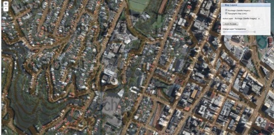
Photo: A map image of Victoria University and the city from KiwImage, a finely detailed satellite imagery dataset for New Zealand purchased by the Library for education and research
Geographic Information Science (GIS) uses software information systems that work with geospatial data such as aerial photos and road maps. New Zealand Post for instance uses software to find the quickest way to deliver mail while the New Zealand Police use GIS to find areas that might be used for growing cannabis.
GIS can also be harnessed for understanding hazards such as where landslides are likely and what causes them, or thinking about urban expansion.
The postgraduate programme is offered by Victoria with the University of Canterbury. The qualification offers a wide variety of topical, relevant courses.
"The geospatial area is a jobs growth area and it is estimated in Australia alone there is a current shortfall of up to 4,000 positions. Similar shortages are reported in a number of countries, including the USA and are also likely in New Zealand," says Dr de Roiste.
Participation in the programme is from either Victoria or Canterbury campuses and students learn via AccessGrid videoconferencing and other online technologies.
One recent Victoria project in this area has focused on the environment and protecting sustainable farming practices on the East Coast. The research combined local, in-depth knowledge of the land with GIS visualisation tools to explore the effects of changes in land management.
Dr Bethana Jackson, a lecturer from the School of Geography, Environment and Earth Sciences, worked with Dr de Roiste and Master‘s student in Physical Geography Bridget O‘Leary on the project.