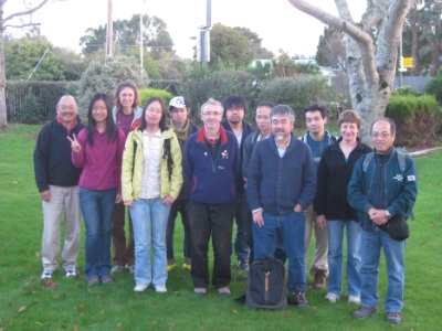
Institute of Geophysics Hosts Workshop
Victoria University’s Institute of Geophysics Hosted a Workshop Recently on the Structure of the Wellington Region
On 16-17 February, Victoria University’s Institute of Geophysics (part of the School of Geography Environment and Earth Sciences), hosted a workshop on the structure of the Wellington region. There was a particual focus on the subduction interface and the Wairarapa fault.
Speakers from GNS Science, the University of Southern California, and the University of Tokyo joined Victoria University students and staff to discuss preliminary results from a joint project called the Seismic Array on the HiKurangi Experiment (SAHKE).
The 'SAHKE' project involved collecting continuous seismograms of earthquakes, background noise and air gun shots on 50 seismometers over a four month period from 2009-2010. Almost 900 seismometers were laid out again across the lower North Island from Glendhu to Kapiti in May of 2011 to record eleven explosions.
The data were combined to create detailed images of the subduction interface, using multiple methods that are all similar in scope to medical imaging.
Future work will allow rock properties to be determined from the seismic wave characteristics. These will be compared to previous similar experiments further north, to try to understand the differences between regions that are slipping smoothly compared to those that have movement released in so-called “slow earthquakes” and those such as the Wellington region that are “locked”, or “stuck”, and so are expected to rupture in earthquakes.

